Topographical Services
Topographic Surveying
Construction Surveying
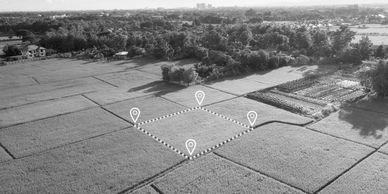
Topographic Surveying

Our topographic surveys provide detailed information about the natural and man-made features of your property. We use state-of-the-art equipment to produce accurate and reliable surveys that are used for a variety of purposes, including land-use planning and engineering design.
Boundary Surveying
Construction Surveying
Topographic Surveying

Our boundary surveying services help you understand your property's boundaries and avoid disputes with neighbors. We use the latest technology to provide detailed and accurate surveys that meet all legal requirements.
Construction Surveying
Construction Surveying
Why choose Emerald Surveys?

Our construction surveying services help ensure that your project is completed on time and within budget. We work closely with your team to provide accurate measurements and precise layouts that meet all engineering and architectural standards.
Why choose Emerald Surveys?
📩 Email us at: info@emeraldsurveys.co.uk
Why choose Emerald Surveys?
- High-resolution digital outputs DWG & REVIT
- Surveys tailored to your scope and specifications
- Experienced, RICS-compliant survey teams
- Transparent, competitive pricing
📩 Email us at: info@emeraldsurveys.co.uk
📩 Email us at: info@emeraldsurveys.co.uk
📩 Email us at: info@emeraldsurveys.co.uk

Or use our Contact Form — it’s quick, easy, and lets us know exactly how we can assist you.